Weicen Chang, Qiumeng Zhong, Sai Liang*, Jianchuan Qi, Jetashree
A high spatial resolution dataset for anthropogenic atmospheric mercury emissions in China during 1998–2014
Scientific Data 9, 604 (2022)
https://doi.org/10.1038/s41597-022-01725-4
ABSTRACT
China is the largest atmospheric mercury (Hg) emitter globally, which has been substantially investigated. However, the estimation of national or regional Hg emissions in China is insufficient in supporting emission control, as the location of the sources may have significant impacts on the effects of Hg emissions. In this concern, high-spatial-resolution datasets of China’s Hg emissions are necessary for in-depth and accurate Hg-related studies and policymaking. Existing gridded datasets are constructed using population distribution as the proxy, which is limited as Hg emissions are closely related to energy consumption and economic processes. This study constructs a dataset of anthropogenic atmospheric Hg emissions in China gridded to a 1 km resolution during 1998–2014. This dataset is produced based on data of land uses, individual enterprises, roadmaps, and population, uncovering Hg emissions in agriculture, industries, services, and residents. This dataset can promote the reliability of Hg-related studies at a high spatial resolution. Moreover, this dataset can support spatially explicit Hg reduction of economic sectors.
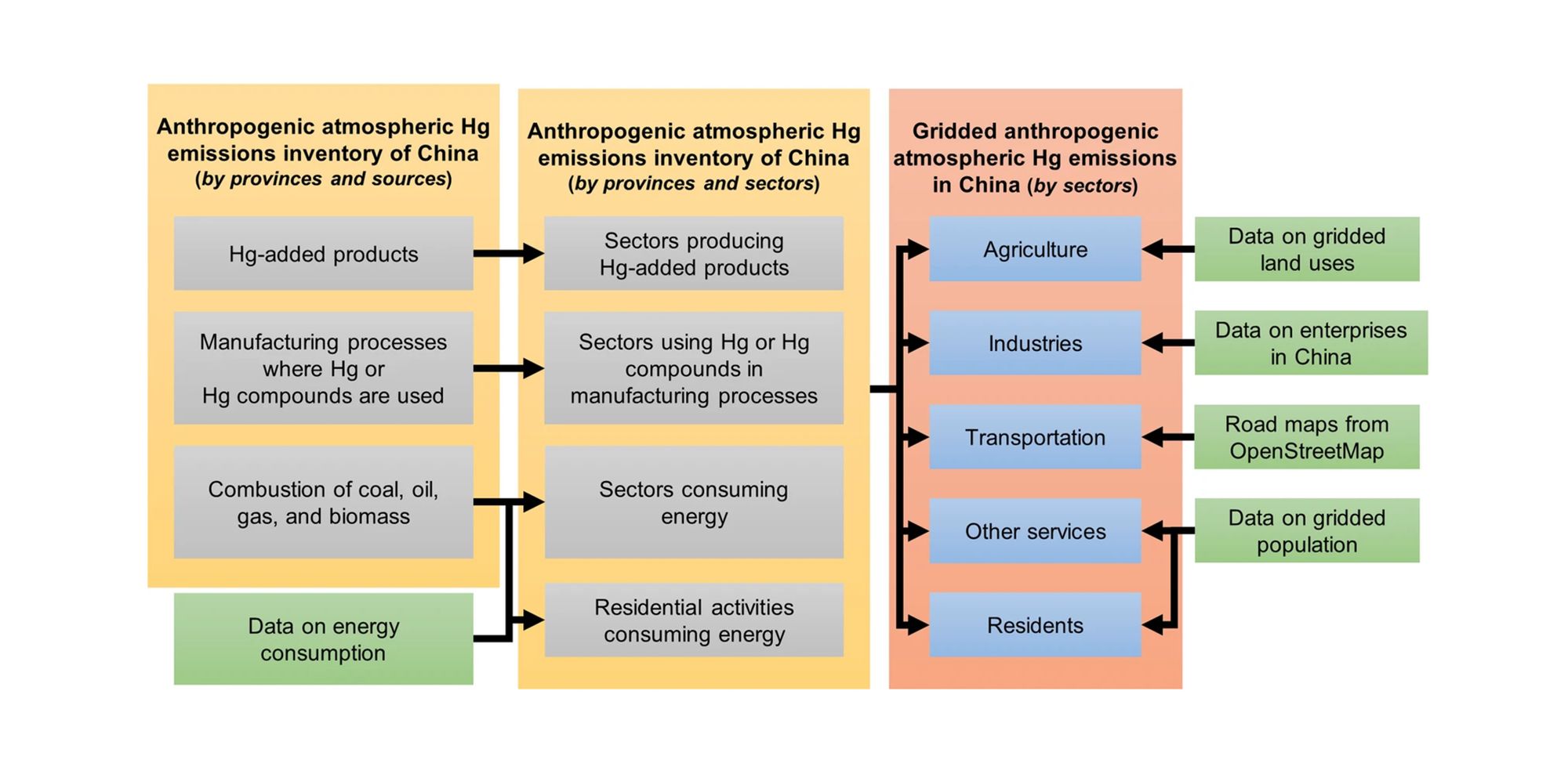
Methods used for constructing the high-spatial-resolution gridded anthropogenic atmospheric Hg emissions dataset for China.
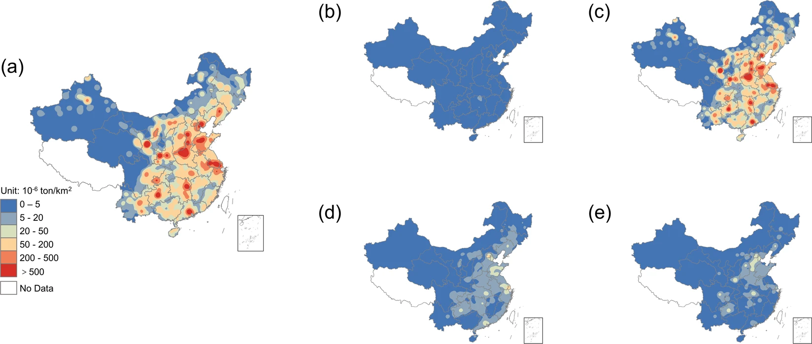
The kernel density maps of anthropogenic atmospheric Hg emissions from various sectors in China in 2014. (a) shows the total atmospheric Hg emissions in China. (b–e) show the atmospheric Hg emissions from China’s agriculture, industries, services, and residents, respectively.