Introduction
The high-resolution grid (1km×1km) dataset of mercury emissions in China during 1998-2014 was constructed using a bottom-up approach. This dataset is produced based on data of land uses, individual enterprises, roadmaps, and population, uncovering Hg emissions in agriculture, industries, services, and residents.
This dataset can promote the reliability of Hg-related studies at a high spatial resolution. Moreover, this dataset can support spatially explicit Hg reduction of economic sectors.
Chang, W.; Zhong, Q.; Liang, S.; Qi, J. & Jetashree A high spatial resolution dataset for anthropogenic atmospheric mercury emissions in China during 1998–2014. Scientific Data 9, 604 (2022). https://doi.org/10.1038/s41597-022-01725-4
Chang, W.; Zhong, Q.; Liang, S.; Qi, J. & Jetashree (2022). A high spatial resolution dataset for anthropogenic atmospheric mercury emissions in China during 1998-2014 [Data set]. Zenodo. https://doi.org/10.5281/zenodo.7109776
Example view of data
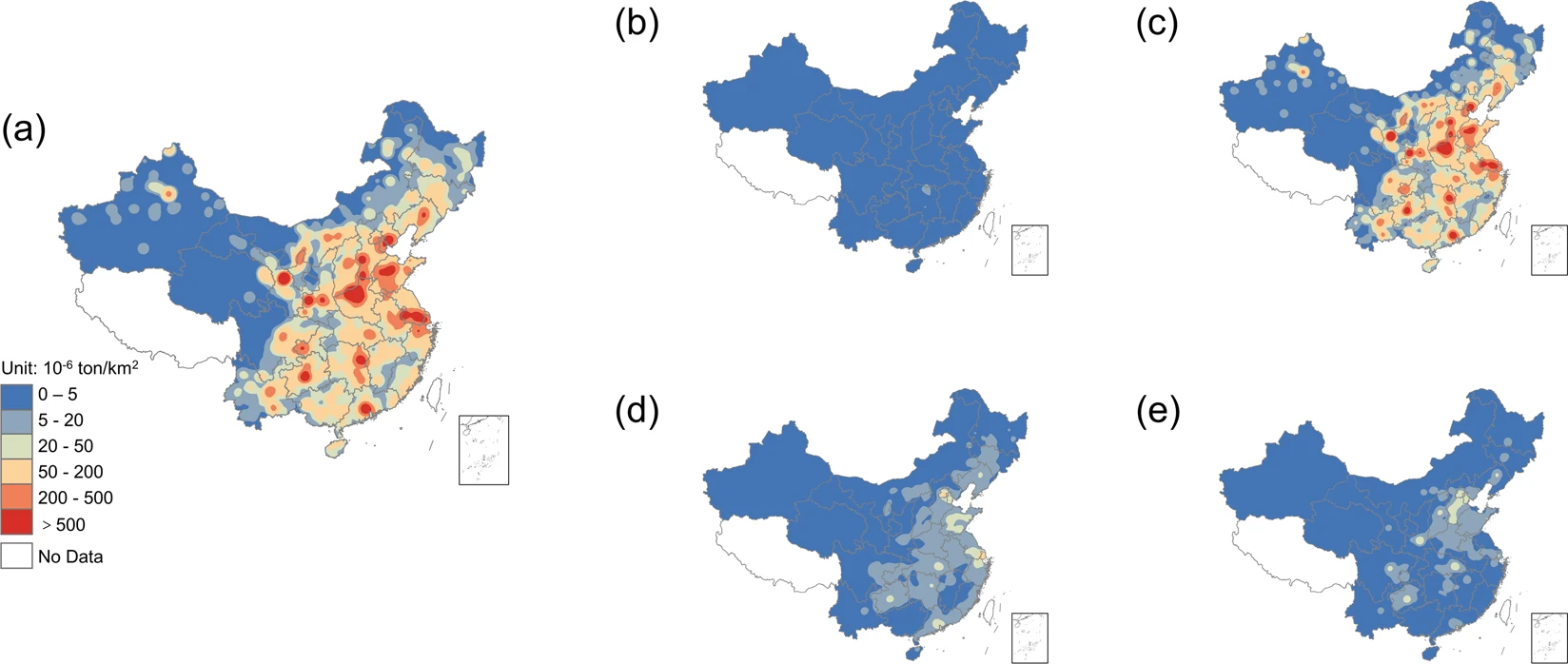
The kernel density maps of anthropogenic atmospheric Hg emissions from various sectors in China in 2014. (a) shows the total atmospheric Hg emissions in China. (b–e) show the atmospheric Hg emissions from China’s agriculture, industries, services, and residents, respectively.